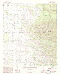
1986 Map of Stanford Canyon
USGS Topo · Published 1986About this map
The Chiricahua Mountains dominate this 1980s landscape, where high-elevation landmarks like Stanford Peak overlook a complex system of drainage and canyons. This provisional survey captures the transition from the arid lowlands of Whitewater Draw to the protected forests of the Chiricahua Wilderness. The map reveals a land defined by water management and topography, tracing the descent of Turkey Creek and Cottonwood Creek from the mountain heights. Human presence is marked by a small Cem (cemetery) located near the foothills, while the Coronado National Forest boundary underscores the division between public range and wilderness areas. Extensive drainage networks including Stanford Canyon, Pridham Canyon, and John Long Canyon illustrate the erosional patterns typical of this portion of Cochise County.
Find a feature on this map
16 named features on this map. Tap any name to fly to it.
Don’t see what you’re looking for? This feature index may not catch every label — zoom into the map to look around manually.
Map Details
Editions of this 1986 Stanford Canyon Map
2 editions found
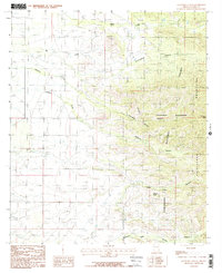
Other maps of this area

1916 · Pearce
USGS Topo · 1:125,000

1917 · Chiricahua
USGS Topo · 1:125,000

1919 · Chiricahua
USGS Topo · 1:125,000

1922 · Swisshelm
USGS Topo · 1:62,500

1926 · Light
USGS Topo · 1:62,500

1926 · Rucker
USGS Topo · 1:62,500

1926 · Pedregosa
USGS Topo · 1:62,500

1955 · Douglas
USGS Topo · 1:250,000

1958 · Chiricahua Peak
USGS Topo · 1:62,500

1958 · Squaretop Hills
USGS Topo · 1:62,500