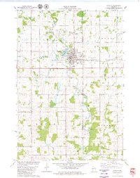
1979 Map of Stanley
USGS Topo · Published 1980About this map
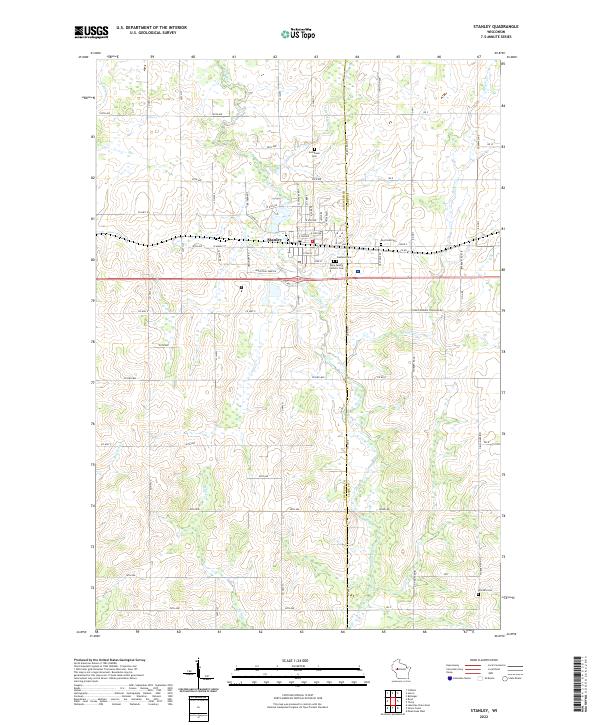
Stanley sits at the heart of this late-1970s landscape, serving as a hub where the Soo Line Railroad cuts through the transition from agricultural fields to the north to the winding course of the Wolf River to the south. The map documents a town established by industry and timber, now centered on civic features like Chapman Park, Fandry Park, and the Stanley-Boyd Sch. The surrounding townships of Delmar, Thorp, Edson, and Worden reveal a high density of rural legacy sites, including numerous family-linked cemeteries such as Evergreen Cem and Oakland Cem. The terrain is punctuated by small-scale resource extraction, marked by various Gravel Pit locations, while smaller waterways like Little Otter Creek and Chapman Lake define the local drainage patterns. Religious life in the outlying sections is anchored by the Maple Grove Ch, illustrating the enduring nature of these rural Wisconsin community centers.
Find a feature on this map
24 named features on this map. Tap any name to fly to it.
Don’t see what you’re looking for? This feature index may not catch every label — zoom into the map to look around manually.
Map Details
Editions of this 1979 Stanley Map
This is the sole edition of this map. No revisions or reprints were ever made.
Historical Maps of Stanley Through Time
3 maps found