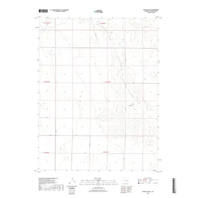
2019 Map of Stanley Gulch
USGS Topo · Published 2019About this map
Stanley Gulch cuts through this high plains landscape of Lincoln County, defining the local drainage system alongside the meandering S Rush Cr. The terrain is marked by a network of seasonal watercourses and the steady expansion of county roads that follow the section lines of the Public Land Survey System. These routes, including Co Rd 29 and Co Rd 27, provide the primary infrastructure for this ranching and agricultural region. Mapping by the U.S. Geological Survey details the subtle elevation changes and the confluence where Rush Cr meets its southern branch, illustrating the fundamental water-and-land relationship in this semi-arid portion of eastern Colorado.
Find a feature on this map
18 named features on this map. Tap any name to fly to it.
Don’t see what you’re looking for? This feature index may not catch every label — zoom into the map to look around manually.
Map Details
Editions of this 2019 Stanley Gulch Map
This is the sole edition of this map. No revisions or reprints were ever made.
Other maps of this area

1889 · Sanborn
USGS Topo · 1:125,000

1891 · Sanborn
USGS Topo · 1:125,000

1891 · Arroyo
USGS Topo · 1:125,000

1893 · Arroyo
USGS Topo · 1:125,000

1893 · Sanborn
USGS Topo · 1:125,000

1954 · Lamar
USGS Topo · 1:250,000

1958 · Lamar
USGS Topo · 1:250,000

1975 · Stanley Gulch
USGS Topo · 1:24,000

1977 · Punkin Center
USGS Topo · 1:24,000
1978 · Beckman Lake
USGS Topo · 1:24,000