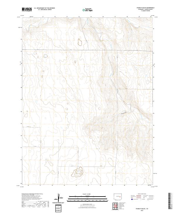
2022 Map of Stanley Gulch
USGS Topo · Published 2022About this map
S Rush Cr and Rush Cr define the hydrological landscape of this eastern Colorado high plains region, where seasonal watercourses have carved distinct relief into the terrain. The namesake Stanley Gulch joins the larger drainage network in the eastern half of the map, illustrating the natural erosion patterns characteristic of Lincoln County. This area is organized by a sparse but regular grid of county roads, including Co Rd 25, Co Rd 27, and Co Rd 29, which facilitate travel across the vast ranching and agricultural lands. The map captures the enduring Public Land Survey System boundaries, specifically showing the intersection of Townships 13S, 14S, and 15S across Ranges 55W and 56W, a layout that has dictated land ownership and development since the era of original homesteading.
Find a feature on this map
18 named features on this map. Tap any name to fly to it.
Don’t see what you’re looking for? This feature index may not catch every label — zoom into the map to look around manually.
Map Details
Editions of this 2022 Stanley Gulch Map
This is the sole edition of this map. No revisions or reprints were ever made.
Other maps of this area

1889 · Sanborn
USGS Topo · 1:125,000

1891 · Sanborn
USGS Topo · 1:125,000

1891 · Arroyo
USGS Topo · 1:125,000

1893 · Arroyo
USGS Topo · 1:125,000

1893 · Sanborn
USGS Topo · 1:125,000

1954 · Lamar
USGS Topo · 1:250,000

1958 · Lamar
USGS Topo · 1:250,000

1975 · Stanley Gulch
USGS Topo · 1:24,000

1977 · Punkin Center
USGS Topo · 1:24,000
1978 · Beckman Lake
USGS Topo · 1:24,000