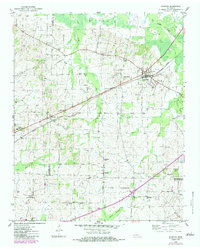
1952 Map of Stanton
USGS Topo · Published 1983About this map
Stanton and the surrounding West Tennessee lowlands are captured here in the early 1950s, revealing a landscape defined by the convergence of the Seaboard Line railroad and the historic Broadway Of America highway. The rail-centered settlement at Stanton is flanked by Birds Bower and smaller rural nodes like Keeling and Meux Corner. This area, where Haywood, Tipton, and Fayette counties meet, shows a high density of rural institutions, including Gailor High Sch, Fredonia Sch, and Green Sch, alongside numerous community landmarks such as Belmont Ch and Bethlehem Ch.
Find a feature on this map
35 named features on this map. Tap any name to fly to it.
Don’t see what you’re looking for? This feature index may not catch every label — zoom into the map to look around manually.
Map Details
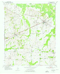
Editions of this 1952 Stanton Map
3 editions found
Other maps of this area

1950 · Brownsville
USGS Topo · 1:24,000

1951 · Brownsville
USGS Topo · 1:24,000

1952 · Stanton
USGS Topo · 1:24,000

1952 · Lambert
USGS Topo · 1:24,000

1952 · Dancyville
USGS Topo · 1:24,000

1952 · Laconia
USGS Topo · 1:24,000

1952 · Stanton
USGS Topo · 1:62,500

1954 · Mason
USGS Topo · 1:62,500

1956 · Blytheville
USGS Topo · 1:250,000

1959 · Blytheville
USGS Topo · 1:250,000