
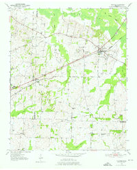
1952 Map of Stanton
USGS Topo · Published 1952About this map
Stanton serves as the focal point of this western Tennessee survey, situated at the junction of the Louisville and Nashville railroad and the Broadway of America highway. The landscape transition from the wooded wetlands of Hatchie Bottom in the north to the rolling hills of the south reveals a 1950s rural economy defined by family-named landmarks like Meux Hill and Birds Bower. Small rural settlements such as Keeling, Fredonia, and Belmont are hubs for social and community life, each anchored by local institutions like the Fredonia Sch or Belmont Ch. The map is particularly useful for genealogists, as it documents numerous smaller burial sites and family plots including Wesley Cem, Chote Cem, and Collier Cems across the Tipton, Haywood, and Fayette county lines.
Find a feature on this map
35 named features on this map. Tap any name to fly to it.
Don’t see what you’re looking for? This feature index may not catch every label — zoom into the map to look around manually.
Map Details
Editions of this 1952 Stanton Map
3 editions found
Other maps of this area

1950 · Brownsville
USGS Topo · 1:24,000

1951 · Brownsville
USGS Topo · 1:24,000

1952 · Lambert
USGS Topo · 1:24,000

1952 · Dancyville
USGS Topo · 1:24,000

1952 · Laconia
USGS Topo · 1:24,000

1952 · Stanton
USGS Topo · 1:62,500

1954 · Mason
USGS Topo · 1:62,500

1956 · Blytheville
USGS Topo · 1:250,000

1959 · Blytheville
USGS Topo · 1:250,000

1961 · Rialto
USGS Topo · 1:62,500