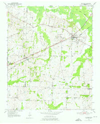
1952 Map of Stanton
USGS Topo · Published 1976About this map
The Louisville and Nashville railroad corridor anchors this 1952 topographic study, following a path through southwestern Tennessee that connects Stanton and Keeling. This landscape is defined by its transition from the rolling uplands down to the fertile Hatchie River bottomlands. The presence of several rural educational institutions, including the Gailor High Sch, Fredonia Sch, and Green Sch, suggests a series of established, dispersed agricultural communities during the mid-century era.
Find a feature on this map
35 named features on this map. Tap any name to fly to it.
Don’t see what you’re looking for? This feature index may not catch every label — zoom into the map to look around manually.
Map Details
Editions of this 1952 Stanton Map
3 editions found
Other maps of this area

1950 · Brownsville
USGS Topo · 1:24,000

1951 · Brownsville
USGS Topo · 1:24,000

1952 · Stanton
USGS Topo · 1:24,000

1952 · Lambert
USGS Topo · 1:24,000

1952 · Dancyville
USGS Topo · 1:24,000

1952 · Laconia
USGS Topo · 1:24,000

1952 · Stanton
USGS Topo · 1:62,500

1954 · Mason
USGS Topo · 1:62,500

1956 · Blytheville
USGS Topo · 1:250,000

1959 · Blytheville
USGS Topo · 1:250,000