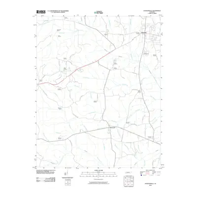
2010 Map of Stantonville
USGS Topo · Published 2010About this map
Stantonville and the southern edge of Adamsville anchor this 2010 depiction of the Tennessee countryside, where an intricate network of rural roads and family cemeteries reveals the region's deep-rooted community structure. The landscape is defined by the convergence of numerous watercourses, including Snake Creek, Owl Creek, and Clear Creek, which carve through the terrain near Dutchman Hollow and Bateman Hollow. Evidence of early transit persists in the alignment of Old Stage Rd, while smaller settlements like Martin Camp dot the secondary routes. Genealogists will find a wealth of local landmarks, ranging from Combs Cemetery in the north to West Shiloh Cemetery in the southeast, alongside several others like Pounds Cemetery and Mount Zion Cemetery. Modern features like Tanyard Springs Dam and numerous private lanes illustrate the contemporary use of this agricultural and wooded landscape.
Find a feature on this map
75 named features on this map. Tap any name to fly to it.
Don’t see what you’re looking for? This feature index may not catch every label — zoom into the map to look around manually.
Map Details
Editions of this 2010 Stantonville Map
This is the sole edition of this map. No revisions or reprints were ever made.
Other maps of this area

1936 · Counce
USGS Topo · 1:24,000

1936 · Leapwood
USGS Topo · 1:24,000

1936 · Milledgeville
USGS Topo · 1:24,000

1936 · Pittsburg Landing
USGS Topo · 1:24,000

1936 · Purdy
USGS Topo · 1:24,000

1936 · Stantonville
USGS Topo · 1:24,000

1936 · Michie
USGS Topo · 1:24,000

1936 · Mt. Peter
USGS Topo · 1:24,000

1949 · Pittsburg Landing
USGS Topo · 1:24,000

1949 · Leapwood
USGS Topo · 1:24,000