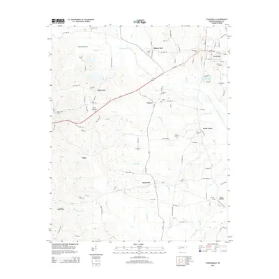
2014 Map of Stantonville
USGS Topo · Published 2014About this map
Adamsville serves as the primary population center in the northeast corner of this McNairy County landscape, where W Main St and E Main St anchor the local road network. The surrounding terrain is defined by the Tennessee Valley Divide, a natural ridge line that separates the drainage patterns of the region. To the north, Horse Cr and Little Snake Cr wind through the hills, while the southern portion is marked by the branching waters of Owl Cr and the Middle Fork Owl Cr.
Find a feature on this map
112 named features on this map. Tap any name to fly to it.
Don’t see what you’re looking for? This feature index may not catch every label — zoom into the map to look around manually.
Map Details
Editions of this 2014 Stantonville Map
This is the sole edition of this map. No revisions or reprints were ever made.
Other maps of this area

1936 · Counce
USGS Topo · 1:24,000

1936 · Leapwood
USGS Topo · 1:24,000

1936 · Milledgeville
USGS Topo · 1:24,000

1936 · Pittsburg Landing
USGS Topo · 1:24,000

1936 · Purdy
USGS Topo · 1:24,000

1936 · Stantonville
USGS Topo · 1:24,000

1936 · Michie
USGS Topo · 1:24,000

1936 · Mt. Peter
USGS Topo · 1:24,000

1949 · Pittsburg Landing
USGS Topo · 1:24,000

1949 · Leapwood
USGS Topo · 1:24,000