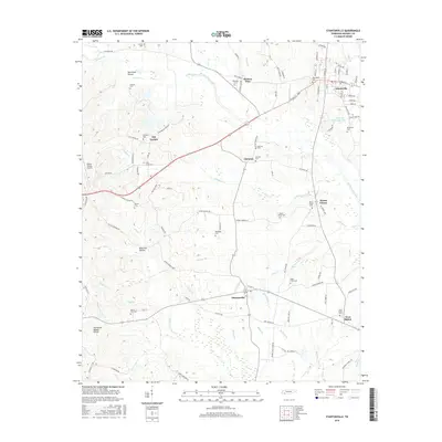
2016 Map of Stantonville
USGS Topo · Published 2016About this map
Adamsville and Stantonville anchor this McNairy County landscape, situated along a network of creek drainages and historic road corridors. The Tennessee Valley Divide cuts through the southwestern corner, a significant topographic marker separating the various forks of Owl Cr from the northern water systems. This area is notably dense with family and community burial grounds, including the Williams Cem near Hickory Flats and the McWhirter Cem east of Adamsville. The terrain is defined by numerous named hollows such as Dutchman Hollow and Bateman Hollow, which illustrate the local drainage patterns into Horse Cr and Graham Cr. Further east, the Snake Creek Canal represents a managed water system through the flatter lowlands, contrasting with the winding natural courses of Teuton Br and Clear Cr that characterize the rural stretches between Gilchrist and Mount Vinson.
Find a feature on this map
119 named features on this map. Tap any name to fly to it.
Don’t see what you’re looking for? This feature index may not catch every label — zoom into the map to look around manually.
Map Details
Editions of this 2016 Stantonville Map
This is the sole edition of this map. No revisions or reprints were ever made.
Other maps of this area

1936 · Counce
USGS Topo · 1:24,000

1936 · Leapwood
USGS Topo · 1:24,000

1936 · Milledgeville
USGS Topo · 1:24,000

1936 · Pittsburg Landing
USGS Topo · 1:24,000

1936 · Purdy
USGS Topo · 1:24,000

1936 · Stantonville
USGS Topo · 1:24,000

1936 · Michie
USGS Topo · 1:24,000

1936 · Mt. Peter
USGS Topo · 1:24,000

1949 · Pittsburg Landing
USGS Topo · 1:24,000

1949 · Leapwood
USGS Topo · 1:24,000