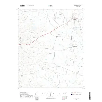
2019 Map of Stantonville
USGS Topo · Published 2019About this map
Adamsville and Stantonville anchor this McNairy County landscape, where the terrain transitions across the Tennessee Valley Divide. The map illustrates a dense network of family-named landmarks and rural burial grounds, including McWhirter Cem and Sanders Cem, which offer significant value for genealogical research in the region. Local hydrology is defined by the Snake Creek Canal and the headwaters of numerous branches like Tanyard Br and Horse Cr. Transportation history is visible through the presence of Old Stage Rd in the north and the Robert Sibley Airport to the west. Small settlements such as Old Lawton, Gilchrist, and West Shiloh appear alongside older paths like Stafford Bottom Rd, reflecting the enduring rural character of these Tennessee communities.
Find a feature on this map
81 named features on this map. Tap any name to fly to it.
Don’t see what you’re looking for? This feature index may not catch every label — zoom into the map to look around manually.
Map Details
Editions of this 2019 Stantonville Map
This is the sole edition of this map. No revisions or reprints were ever made.
Other maps of this area

1936 · Counce
USGS Topo · 1:24,000

1936 · Leapwood
USGS Topo · 1:24,000

1936 · Milledgeville
USGS Topo · 1:24,000

1936 · Pittsburg Landing
USGS Topo · 1:24,000

1936 · Purdy
USGS Topo · 1:24,000

1936 · Stantonville
USGS Topo · 1:24,000

1936 · Michie
USGS Topo · 1:24,000

1936 · Mt. Peter
USGS Topo · 1:24,000

1949 · Pittsburg Landing
USGS Topo · 1:24,000

1949 · Leapwood
USGS Topo · 1:24,000