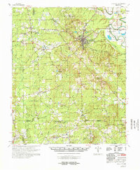
1978 Map of Star City
USGS Topo · Published 1978About this map
Star City stands at the center of this Lincoln County survey, serving as a hub where several regional routes converge, including the Military Road and Ferry Road. The landscape is defined by the winding course of Bayou Bartholomew to the east and a dense network of tributaries like Sanders Creek and Cane Creek. The map documents a deeply rural social geography, marked by numerous small community anchors such as Bethlehem Ch, Antioch Ch, and Hickory Grove Ch. Evidence of early settlement patterns remains visible through established crossroads like Feenyville and Palmyra, and family-named landmarks such as Reifs Bluff. The inclusion of the Gaging Station on the bayou reflects the ongoing hydrological management overseen by the Mississippi River Commission during this era.
Find a feature on this map
77 named features on this map. Tap any name to fly to it.
Don’t see what you’re looking for? This feature index may not catch every label — zoom into the map to look around manually.
Map Details
Editions of this 1978 Star City Map
This is the sole edition of this map. No revisions or reprints were ever made.
Other maps of this area

1935 · Feenyville
USGS Topo · 1:62,500

1935 · Cominto
USGS Topo · 1:62,500

1935 · Varner
USGS Topo · 1:62,500

1935 · Noble Lake
USGS Topo · 1:62,500

1935 · Rotan
USGS Topo · 1:62,500

1948 · Helena
USGS Topo · 1:250,000

1950 · Helena
USGS Topo · 1:250,000

1953 · Greenwood
USGS Topo · 1:250,000

1953 · El Dorado
USGS Topo · 1:250,000

1955 · Helena
USGS Topo · 1:250,000