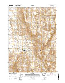
2017 Map of Star Creek Reservoir
USGS Topo · Published 2017About this map
Star Creek Reservoir sits at the heart of this high-desert basin in eastern Oregon, serving as a vital water source in a landscape defined by its seasonal drainages and springs. The map reveals an intricate network of water management, where the Star Cr Ditch connects natural flows like Star Cr to man-made catchments including Sack Canyon Reservoir. Notable landmarks such as Monumental Rock and the geological formation known as The Monuments rise above the surrounding terrain, providing orientation points in the vast acreage between Star Mtn and the Roostercomb. Long-standing ranching infrastructure is evident through named access points like Star Ranch Rd and numerous watering holes such as Whiskey Jack Spring and Stump Spring.
Find a feature on this map
32 named features on this map. Tap any name to fly to it.
Don’t see what you’re looking for? This feature index may not catch every label — zoom into the map to look around manually.
Map Details
Editions of this 2017 Star Creek Reservoir Map
This is the sole edition of this map. No revisions or reprints were ever made.
Other maps of this area

1955 · Burns
USGS Topo · 1:250,000

1955 · Boise
USGS Topo · 1:250,000

1958 · Burns
USGS Topo · 1:250,000

1958 · Boise
USGS Topo · 1:250,000

1959 · Burns
USGS Topo · 1:250,000

1962 · Boise
USGS Topo · 1:250,000

1972 · Burnt Flat
USGS Topo · 1:24,000

1972 · Shumway Reservoir
USGS Topo · 1:24,000

1972 · Alder Creek
USGS Topo · 1:24,000

1972 · Crowley
USGS Topo · 1:24,000