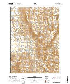
2020 Map of Star Creek Reservoir
USGS Topo · Published 2020About this map
Star Mtn and the surrounding high country of Malheur County define this landscape of water management and distinct geologic formations. The map centers on the Star Cr Reservoir, which, along with Sack Canyon Reservoir and the Star Cr Ditch, reflects a coordinated effort to capture and direct seasonal runoff in this arid corner of eastern Oregon. Dramatic landforms punctuate the terrain, including the sharp rise of Roostercomb and the clusters of The Monuments.
Find a feature on this map
32 named features on this map. Tap any name to fly to it.
Don’t see what you’re looking for? This feature index may not catch every label — zoom into the map to look around manually.
Map Details
Editions of this 2020 Star Creek Reservoir Map
This is the sole edition of this map. No revisions or reprints were ever made.
Other maps of this area

1955 · Burns
USGS Topo · 1:250,000

1955 · Boise
USGS Topo · 1:250,000

1958 · Burns
USGS Topo · 1:250,000

1958 · Boise
USGS Topo · 1:250,000

1959 · Burns
USGS Topo · 1:250,000

1962 · Boise
USGS Topo · 1:250,000

1972 · Burnt Flat
USGS Topo · 1:24,000

1972 · Shumway Reservoir
USGS Topo · 1:24,000

1972 · Alder Creek
USGS Topo · 1:24,000

1972 · Crowley
USGS Topo · 1:24,000