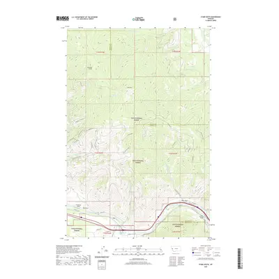
2020 Map of Stark South
USGS Topo · Published 2020About this map
The Clark Fork river carves a deep path through this portion of the Lolo National Forest, where the small settlement of Cyr sits along the southern bank. This rugged corridor in western Montana is defined by sharp elevation changes, climbing from the river basin toward prominent peaks like Stark Mtn and the Ninemile Divide. The landscape is etched with numerous drainages, including Freezeout Gulch, Dry Gulch, and Sawmill Gulch, reflecting the complex hydrology of the Mineral and Missoula county border.
Find a feature on this map
60 named features on this map. Tap any name to fly to it.
Don’t see what you’re looking for? This feature index may not catch every label — zoom into the map to look around manually.
Map Details
Editions of this 2020 Stark South Map
This is the sole edition of this map. No revisions or reprints were ever made.
Other maps of this area

1911 · Lolo
USGS Topo · 1:250,000

1912 · Missoula
USGS Topo · 1:125,000

1913 · Lolo
USGS Topo · 1:250,000

1956 · Wallace
USGS Topo · 1:250,000

1956 · Hamilton
USGS Topo · 1:250,000

1959 · Hamilton
USGS Topo · 1:250,000

1959 · Tarkio
USGS Topo · 1:62,500

1959 · Alberton
USGS Topo · 1:62,500

1960 · Wallace
USGS Topo · 1:250,000

1960 · Hamilton
USGS Topo · 1:250,000