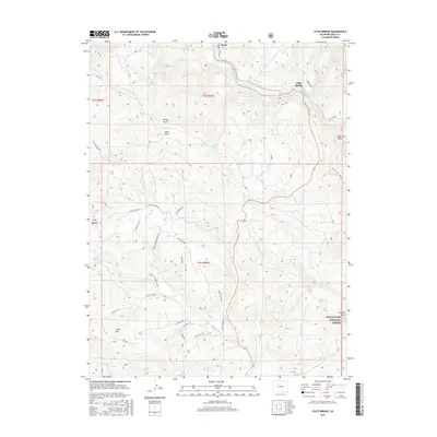
2016 Map of State Bridge
USGS Topo · Published 2016About this map
The confluence of the Colorado River and the Piney River anchors this mountainous region of Eagle County, where the historic settlements of State Bridge and Bond serve as vital transit points. The landscape is defined by dramatic elevation changes, rising from the riverbanks to the summit of Horse Mtn and the distinct overlook at Windy Point. A network of winding mountain roads, including Trough Rd and Piney River Rd, follows the contours of the terrain, connecting isolated ranch sites and gulches like Cabin Gulch and High Trail Gulch.
Find a feature on this map
44 named features on this map. Tap any name to fly to it.
Don’t see what you’re looking for? This feature index may not catch every label — zoom into the map to look around manually.
Map Details
Editions of this 2016 State Bridge Map
This is the sole edition of this map. No revisions or reprints were ever made.
Other maps of this area

1957 · Leadville
USGS Topo · 1:250,000

1959 · Leadville
USGS Topo · 1:250,000

1960 · Leadville
USGS Topo · 1:250,000

1962 · Leadville
USGS Topo · 1:250,000

1962 · Wolcott
USGS Topo · 1:24,000

1962 · Eagle
USGS Topo · 1:24,000

1962 · Edwards
USGS Topo · 1:24,000

1964 · Leadville
USGS Topo · 1:250,000
1972 · Mc Coy
USGS Topo · 1:24,000

1972 · Blue Hill
USGS Topo · 1:24,000