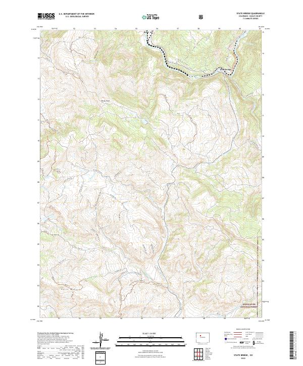
2022 Map of State Bridge
USGS Topo · Published 2022About this map
State Bridge and the neighboring settlement of Bond serve as the primary human touchpoints in this section of the Colorado River canyon. The landscape is defined by the sharp descent of tributaries like Elk Cr and Goodson Cr into the main river valley, where rail and road infrastructure must contend with the complex topography of the Eagle County high country. To the south, the terrain rises toward Horse Mtn and enters the northern reaches of the White River National Forest, a transition marked by a shift from the river-bottom corridor to a high-elevation network of forest service trails and ranch roads.
Find a feature on this map
61 named features on this map. Tap any name to fly to it.
Don’t see what you’re looking for? This feature index may not catch every label — zoom into the map to look around manually.
Map Details
Editions of this 2022 State Bridge Map
This is the sole edition of this map. No revisions or reprints were ever made.
Other maps of this area

1957 · Leadville
USGS Topo · 1:250,000

1959 · Leadville
USGS Topo · 1:250,000

1960 · Leadville
USGS Topo · 1:250,000

1962 · Leadville
USGS Topo · 1:250,000

1962 · Wolcott
USGS Topo · 1:24,000

1962 · Eagle
USGS Topo · 1:24,000

1962 · Edwards
USGS Topo · 1:24,000

1964 · Leadville
USGS Topo · 1:250,000
1972 · Mc Coy
USGS Topo · 1:24,000

1972 · Blue Hill
USGS Topo · 1:24,000