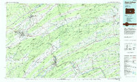
1984 Map of State College
USGS Topo · Published 1985About this map
The sprawling campus of Pennsylvania State University dominates the valley landscape at the heart of this 1984 survey. The region is defined by the rhythmic ridges of the Ridge-and-Valley Appalachians, including Nittany Mountain and Bald Eagle Mountain, which channel settlement and transport into long, narrow corridors. Historic industrial and agricultural hubs like Bellefonte, Lewistown, and Mifflintown are linked by a complex network of waterways including the Juniata River and the Susquehanna River.
Find a feature on this map
128 named features on this map. Tap any name to fly to it.
Don’t see what you’re looking for? This feature index may not catch every label — zoom into the map to look around manually.
Map Details
Editions of this 1984 State College Map
This is the sole edition of this map. No revisions or reprints were ever made.
Other maps of this area

1892 · Harrisburg
USGS Topo · 1:62,500

1893 · Sunbury
USGS Topo · 1:62,500

1893 · Millersburg
USGS Topo · 1:62,500

1899 · Harrisburg
USGS Topo · 1:62,500

1901 · Huntingdon
USGS Topo · 1:62,500

1904 · Huntingdon
USGS Topo · 1:62,500

1907 · New Bloomfield
USGS Topo · 1:62,500

1907 · Millerstown
USGS Topo · 1:62,500

1908 · Bellefonte
USGS Topo · 1:62,500

1909 · Bellefonte
USGS Topo · 1:62,500