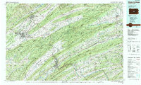
1988 Map of State College
USGS Topo · Published 1989About this map
Pennsylvania State University serves as a central anchor in this 1980s landscape, illustrating the late-twentieth-century expansion of State College. The map documents a complex ridge-and-valley topography defined by massive formations such as Nittany Mountain and Bald Eagle Mountain. These natural barriers historically dictated the growth of settlements like Bellefonte, the seat of the Centre County Courthouse, and industrial corridors along the Juniata River and Susquehanna River.
Find a feature on this map
298 named features on this map. Tap any name to fly to it.
Don’t see what you’re looking for? This feature index may not catch every label — zoom into the map to look around manually.
Map Details
Editions of this 1988 State College Map
This is the sole edition of this map. No revisions or reprints were ever made.
Other maps of this area

1892 · Harrisburg
USGS Topo · 1:62,500

1893 · Sunbury
USGS Topo · 1:62,500

1893 · Millersburg
USGS Topo · 1:62,500

1899 · Harrisburg
USGS Topo · 1:62,500

1901 · Huntingdon
USGS Topo · 1:62,500

1904 · Huntingdon
USGS Topo · 1:62,500

1907 · New Bloomfield
USGS Topo · 1:62,500

1907 · Millerstown
USGS Topo · 1:62,500

1908 · Bellefonte
USGS Topo · 1:62,500

1909 · Bellefonte
USGS Topo · 1:62,500