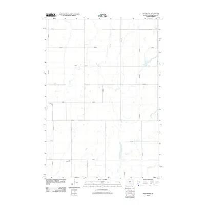
2012 Map of Staum Dam
USGS Topo · Published 2012About this map
Shue Cr and Pearl Cr carve paths through the Beadle County prairie, defining the rural character of this northern Great Plains landscape. The map reveals a strictly organized section-line grid of roads, such as 191st St and 411th Ave, which connect the isolated farmsteads and agricultural operations of the region. Local heritage is preserved at sites like Petrodie Cem in the northeast and Saint Williams Cem further south. The namesake Staum Dam serves as a notable hydrologic feature along the creek system, reflecting the vital importance of water management in this open terrain. This survey provides a precise view of the rural infrastructure, from the path of Co Hwy 31 to the smaller drainages of Middle Pearl Cr.
Find a feature on this map
22 named features on this map. Tap any name to fly to it.
Don’t see what you’re looking for? This feature index may not catch every label — zoom into the map to look around manually.
Map Details
Editions of this 2012 Staum Dam Map
This is the sole edition of this map. No revisions or reprints were ever made.
Other maps of this area

1895 · Byron
USGS Topo · 1:125,000

1898 · Huron
USGS Topo · 1:125,000

1899 · De Smet
USGS Topo · 1:125,000

1953 · Huron
USGS Topo · 1:250,000

1953 · Watertown
USGS Topo · 1:250,000

1954 · Huron
USGS Topo · 1:250,000

1956 · Lake Byron SE
USGS Topo · 1:24,000

1958 · Watertown
USGS Topo · 1:250,000
1958 · Huron NE
USGS Topo · 1:24,000

1971 · Bancroft West
USGS Topo · 1:24,000