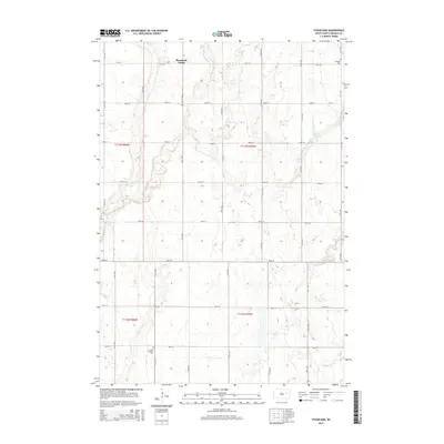
2015 Map of Staum Dam
USGS Topo · Published 2015About this map
Shamrock Colony occupies the northern reaches of this Beadle County landscape, situated within a vast network of section-line roads such as 191st St and 414th Ave. The terrain is defined by the subtle drainage of Shue Cr and Pearl Cr, which meander across the prairie toward the impoundment at Staum Dam in the northeast. This 2015 survey reflects the enduring rural structure of South Dakota's eastern plains, where long-standing communal settlements like the Hutterite colony persist alongside traditional family farmsteads.
Find a feature on this map
26 named features on this map. Tap any name to fly to it.
Don’t see what you’re looking for? This feature index may not catch every label — zoom into the map to look around manually.
Map Details
Editions of this 2015 Staum Dam Map
This is the sole edition of this map. No revisions or reprints were ever made.
Other maps of this area

1895 · Byron
USGS Topo · 1:125,000

1898 · Huron
USGS Topo · 1:125,000

1899 · De Smet
USGS Topo · 1:125,000

1953 · Huron
USGS Topo · 1:250,000

1953 · Watertown
USGS Topo · 1:250,000

1954 · Huron
USGS Topo · 1:250,000

1956 · Lake Byron SE
USGS Topo · 1:24,000

1958 · Watertown
USGS Topo · 1:250,000
1958 · Huron NE
USGS Topo · 1:24,000

1971 · Bancroft West
USGS Topo · 1:24,000