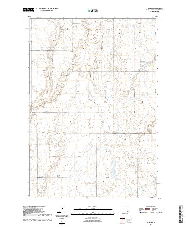
2021 Map of Staum Dam
USGS Topo · Published 2021About this map
The agricultural landscape of Beadle County is defined here by the drainage networks of Shue Cr and Pearl Cr, which meander through a strictly partitioned grid of section lines. This 2021 survey illustrates the modern layout of rural South Dakota, where water management is centralized around features like Staum Dam. Evidence of the area's pioneer heritage and family lineages is found at the Petrodie Cem in the northeast and Saint Williams Cem further south. These small, isolated cemeteries serve as primary markers of local history amidst the expansive fields. The road network, comprising a series of numbered avenues and streets like 414th Ave and 193rd St, facilitates the movement between these farming homesteads and the nearby water bodies, including Middle Pearl Cr.
Find a feature on this map
28 named features on this map. Tap any name to fly to it.
Don’t see what you’re looking for? This feature index may not catch every label — zoom into the map to look around manually.
Map Details
Editions of this 2021 Staum Dam Map
This is the sole edition of this map. No revisions or reprints were ever made.
Other maps of this area

1895 · Byron
USGS Topo · 1:125,000

1898 · Huron
USGS Topo · 1:125,000

1899 · De Smet
USGS Topo · 1:125,000

1953 · Huron
USGS Topo · 1:250,000

1953 · Watertown
USGS Topo · 1:250,000

1954 · Huron
USGS Topo · 1:250,000

1956 · Lake Byron SE
USGS Topo · 1:24,000

1958 · Watertown
USGS Topo · 1:250,000
1958 · Huron NE
USGS Topo · 1:24,000

1971 · Bancroft West
USGS Topo · 1:24,000