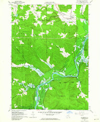
1962 Map of Steamburg
USGS Topo · Published 1964About this map
The Allegheny River valley near the Pennsylvania border is captured here during a period of massive environmental and cultural transformation. The 1962 fieldwork documents the impending inundation of the region, with blue hatching indicating the vast areas slated to be submerged by the Allegheny Reservoir. This project fundamentally altered the Allegany Indian Reservation, impacting riverside settlements like Onoville and Oldtown. The map records these communities and the Oldtown Cem just before the rising waters changed the landscape forever.
Find a feature on this map
55 named features on this map. Tap any name to fly to it.
Don’t see what you’re looking for? This feature index may not catch every label — zoom into the map to look around manually.
Map Details
Editions of this 1962 Steamburg Map
3 editions found
Other maps of this area

1905 · Jamestown
USGS Topo · 1:62,500

1906 · Warren
USGS Topo · 1:62,500

1907 · Warren
USGS Topo · 1:62,500

1908 · Warren
USGS Topo · 1:62,500

1922 · Randolph
USGS Topo · 1:62,500

1923 · Randolph
USGS Topo · 1:62,500

1936 · Kinzua
USGS Topo · 1:48,000

1941 · Kinzua
USGS Topo · 1:62,500

1942 · Jamestown
USGS Topo · 1:62,500

1943 · Randolph
USGS Topo · 1:62,500