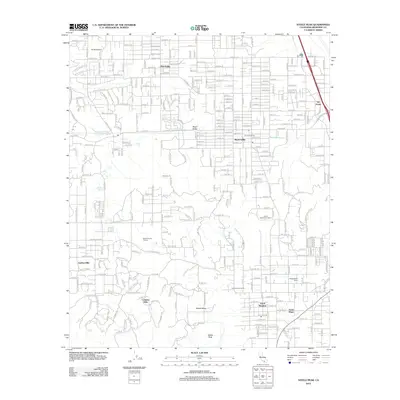
2012 Map of Steele Peak
USGS Topo · Published 2012About this map
Mead Valley and the surrounding high desert terrain define this portrait of Riverside County during the early 21st century. The landscape is a network of rural residential pockets and established ranch lands, including the Morris Washington Ranch and Wagonwheel Ranch. A critical piece of regional infrastructure, the Colorado River Aqueduct, cuts across the center of the sheet, disappearing underground at the Val Verde Tunnel near the community of Val Verde.
Find a feature on this map
148 named features on this map. Tap any name to fly to it.
Don’t see what you’re looking for? This feature index may not catch every label — zoom into the map to look around manually.
Map Details
Editions of this 2012 Steele Peak Map
This is the sole edition of this map. No revisions or reprints were ever made.
Other maps of this area

1901 · Southern California Sheet No. 1
USGS Topo · 1:250,000

1901 · Elsinore
USGS Topo · 1:125,000

1901 · Riverside
USGS Topo · 1:62,500

1904 · Southern California Sheet No. 1
USGS Topo · 1:250,000

1942 · Lake Elsinore
USGS Topo · 1:62,500
1942 · Riverside and Vicinity
USGS Topo · 1:31,680

1942 · Murrieta
USGS Topo · 1:62,500

1942 · Riverside
USGS Topo · 1:62,500

1942 · Perris
USGS Topo · 1:62,500

1943 · Perris
USGS Topo · 1:62,500