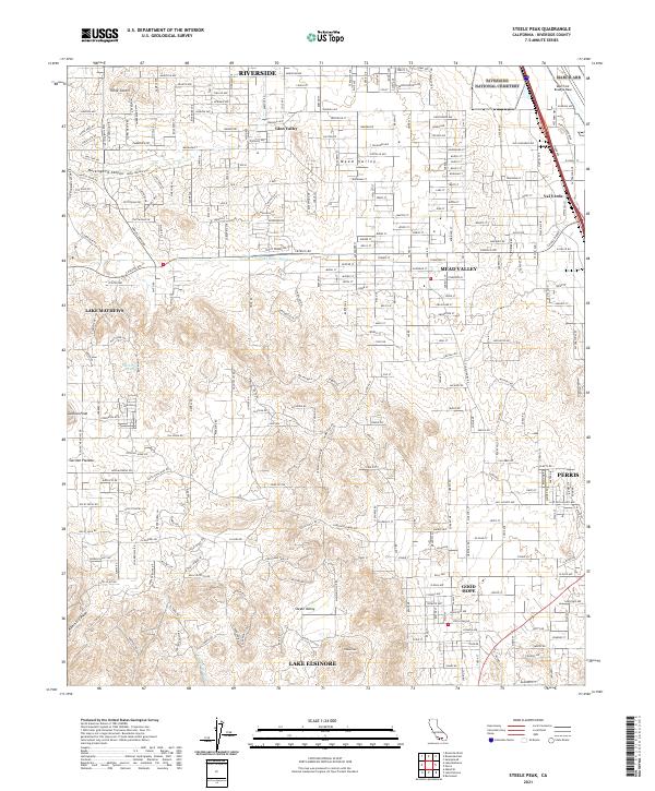
2021 Map of Steele Peak
USGS Topo · Published 2021About this map
Glen Valley and Mead Valley define the northern expanse of this 2021 landscape, showing a transition from the edges of Riverside toward the more open terrain surrounding Steele Peak. The industrial and utility infrastructure of Southern California is clearly visible, anchored by the Colorado River Aqueduct cutting across the central portion of the sheet and the military presence at March Air Reserve Base to the northeast. To the south, the settlement of Good Hope and the northern reaches of Lake Elsinore provide a detailed look at contemporary parceling and community development. Higher elevations like Gavilan Peak and the Gavilan Plateau frame the western edge, while the city of Perris occupies the eastern boundary, illustrating the dense road networks of Nandina Ave and Mariposa Ave that connect these growing desert communities.
Find a feature on this map
164 named features on this map. Tap any name to fly to it.
Don’t see what you’re looking for? This feature index may not catch every label — zoom into the map to look around manually.
Map Details
Editions of this 2021 Steele Peak Map
This is the sole edition of this map. No revisions or reprints were ever made.
Other maps of this area

1901 · Southern California Sheet No. 1
USGS Topo · 1:250,000

1901 · Elsinore
USGS Topo · 1:125,000

1901 · Riverside
USGS Topo · 1:62,500

1904 · Southern California Sheet No. 1
USGS Topo · 1:250,000

1942 · Lake Elsinore
USGS Topo · 1:62,500
1942 · Riverside and Vicinity
USGS Topo · 1:31,680

1942 · Murrieta
USGS Topo · 1:62,500

1942 · Riverside
USGS Topo · 1:62,500

1942 · Perris
USGS Topo · 1:62,500

1943 · Perris
USGS Topo · 1:62,500