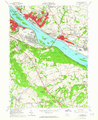
1963 Map of Steelton
USGS Topo · Published 1965About this map
Industrial activity and military infrastructure dominate the Susquehanna River corridor south of Harrisburg in the early 1960s. The dense steelworks and slag dump of Steelton and Highspire sit directly across the river from the sprawling Harrisburg-York State Airport and the New Cumberland General Depot. This period captures the landscape just before the closure of Olmsted Air Force Base at the eastern edge, showing the vital role this river bend played in national logistics and production.
Find a feature on this map
80 named features on this map. Tap any name to fly to it.
Don’t see what you’re looking for? This feature index may not catch every label — zoom into the map to look around manually.
Map Details
Editions of this 1963 Steelton Map
3 editions found
Other maps of this area

1892 · Hummelstown
USGS Topo · 1:62,500

1892 · Harrisburg
USGS Topo · 1:62,500

1899 · Harrisburg
USGS Topo · 1:62,500

1906 · New Cumberland
USGS Topo · 1:62,500

1908 · Middletown
USGS Topo · 1:62,500

1924 · Hummelstown
USGS Topo · 1:62,500

1924 · Harrisburg
USGS Topo · 1:62,500

1943 · New Cumberland
USGS Topo · 1:62,500

1943 · Middletown
USGS Topo · 1:62,500

1943 · Harrisburg
USGS Topo · 1:62,500