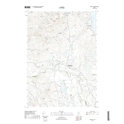
2018 Map of Steep Falls
USGS Topo · Published 2018About this map
Steep Falls and the winding course of the Saco River define this corner of the Maine landscape, where the river serves as the natural boundary between Cumberland Co and York Co. The settlement pattern is deeply tied to the terrain, with clusters like East Baldwin Mattocks Station and North Baldwin following the lowlands near water, while family-named hills like Douglas Mtn and Webb Rowe Mtn rise to the north.
Find a feature on this map
132 named features on this map. Tap any name to fly to it.
Don’t see what you’re looking for? This feature index may not catch every label — zoom into the map to look around manually.
Map Details
Editions of this 2018 Steep Falls Map
This is the sole edition of this map. No revisions or reprints were ever made.
Other maps of this area

1891 · Buxton
USGS Topo · 1:62,500

1891 · Newfield
USGS Topo · 1:62,500

1892 · Buxton
USGS Topo · 1:62,500

1893 · Buxton
USGS Topo · 1:62,500

1893 · Newfield
USGS Topo · 1:62,500

1896 · Sebago
USGS Topo · 1:62,500

1910 · Kezar Falls
USGS Topo · 1:48,000

1911 · Kezar Falls
USGS Topo · 1:62,500

1933 · Newfield
USGS Topo · 1:48,000

1937 · Newfield
USGS Topo · 1:62,500