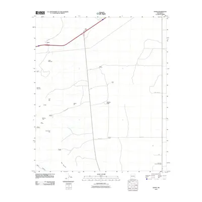
2010 Map of Steins
USGS Topo · Published 2010About this map
Mining operations and ranching outposts define the high-desert landscape of this corner of Hidalgo County. The settlement of Steins sits along the northern rail and road corridor, serving as a landmark near the pass. To the south, the Peloncillo Mountains and surrounding foothills are dotted with evidence of historical mineral exploration, including the North Star Mine, Silver Hill Mine, and the Carbonate Hill Mine near McGhee Peak. These sites, along with the New Year Prospect and Johnny Bull Mine, reveal the area's geological draw for prospectors.
Find a feature on this map
29 named features on this map. Tap any name to fly to it.
Don’t see what you’re looking for? This feature index may not catch every label — zoom into the map to look around manually.
Map Details
Editions of this 2010 Steins Map
This is the sole edition of this map. No revisions or reprints were ever made.
Other maps of this area

1917 · San Simon
USGS Topo · 1:125,000

1926 · Orange Butte
USGS Topo · 1:62,500

1928 · Chenoweth
USGS Topo · 1:62,500

1950 · San Simon
USGS Topo · 1:62,500

1950 · Vanar
USGS Topo · 1:62,500

1951 · Vanar
USGS Topo · 1:62,500

1951 · San Simon
USGS Topo · 1:62,500

1954 · Silver City
USGS Topo · 1:250,000

1958 · Silver City
USGS Topo · 1:250,000

1962 · Silver City
USGS Topo · 1:250,000