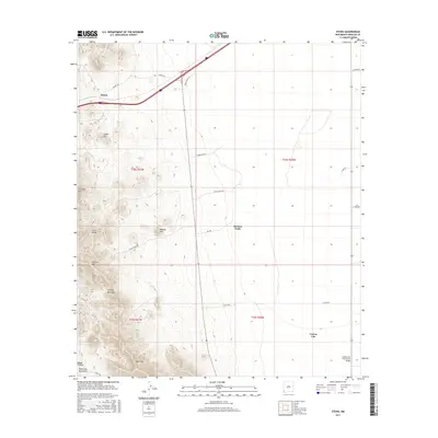
2017 Map of Steins
USGS Topo · Published 2017About this map
Peloncillo Mountains topography defines this high-desert landscape in Hidalgo County, where the transition from rugged peaks to the western Animas Valley floor is marked by isolated settlements and ranching infrastructure. Steins and Cotton City serve as the primary human touchpoints in an area characterized by steep relief and critical mountain passes. The presence of McGhee Mine Rd and Smith Ranch Rd suggests a history of mineral exploration and livestock management that has long shaped the local economy.
Find a feature on this map
32 named features on this map. Tap any name to fly to it.
Don’t see what you’re looking for? This feature index may not catch every label — zoom into the map to look around manually.
Map Details
Editions of this 2017 Steins Map
This is the sole edition of this map. No revisions or reprints were ever made.
Other maps of this area

1917 · San Simon
USGS Topo · 1:125,000

1926 · Orange Butte
USGS Topo · 1:62,500

1928 · Chenoweth
USGS Topo · 1:62,500

1950 · San Simon
USGS Topo · 1:62,500

1950 · Vanar
USGS Topo · 1:62,500

1951 · Vanar
USGS Topo · 1:62,500

1951 · San Simon
USGS Topo · 1:62,500

1954 · Silver City
USGS Topo · 1:250,000

1958 · Silver City
USGS Topo · 1:250,000

1962 · Silver City
USGS Topo · 1:250,000