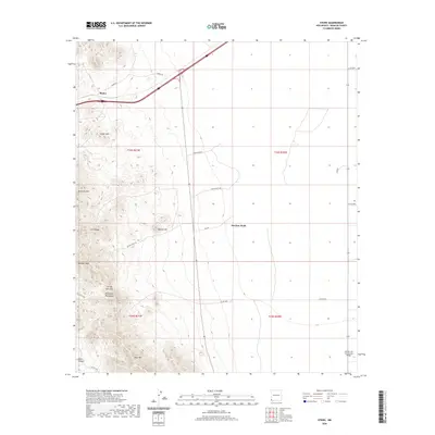
2020 Map of Steins
USGS Topo · Published 2020About this map
Steins sits at the northern edge of this high-desert landscape in Hidalgo County, where the infrastructure of the American Southwest meets the foothills of the Peloncillo Mountains. This modern record of the terrain highlights the complex network of ranch and mining roads, such as McGhee Mine Rd and Smith Ranch Rd, that crisscross the land to access remote landmarks like McGhee Wells and Johnny Bull Gap. The topographic data reveals the prominence of local elevations including Cedar Mtn, Attorney Mtn, and McGhee Peak. To the south, the Cotton City Community Bridge provides a point of reference for local connectivity near Wood Canyon. The map preserves the spatial relationship between legacy land divisions, such as t24s r21w, and the natural ridges of Still Ridge and Blue Mtn.
Find a feature on this map
28 named features on this map. Tap any name to fly to it.
Don’t see what you’re looking for? This feature index may not catch every label — zoom into the map to look around manually.
Map Details
Editions of this 2020 Steins Map
This is the sole edition of this map. No revisions or reprints were ever made.
Other maps of this area

1917 · San Simon
USGS Topo · 1:125,000

1926 · Orange Butte
USGS Topo · 1:62,500

1928 · Chenoweth
USGS Topo · 1:62,500

1950 · San Simon
USGS Topo · 1:62,500

1950 · Vanar
USGS Topo · 1:62,500

1951 · Vanar
USGS Topo · 1:62,500

1951 · San Simon
USGS Topo · 1:62,500

1954 · Silver City
USGS Topo · 1:250,000

1958 · Silver City
USGS Topo · 1:250,000

1962 · Silver City
USGS Topo · 1:250,000