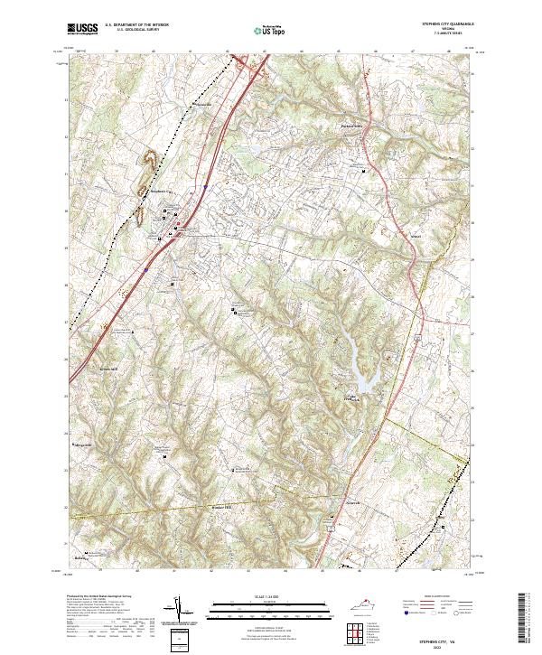
2022 Map of Stephens City
USGS Topo · Published 2022About this map
Stephens City serves as the focal point of this Frederick County landscape, where the historical footprint of early settlement is preserved through numerous family and congregational burial grounds. The map documents significant genealogical sites such as the Peter Stephens Farm Cem and the Old Graveyard, alongside the Stephens City United Methodist Church Cem. These features, combined with the legacy of localized industry at Klines Mill and Ridings Mill, reflect a community built around the small waterways of Stephens Run and Crooked Run.
Find a feature on this map
174 named features on this map. Tap any name to fly to it.
Don’t see what you’re looking for? This feature index may not catch every label — zoom into the map to look around manually.
Map Details
Editions of this 2022 Stephens City Map
This is the sole edition of this map. No revisions or reprints were ever made.
Other maps of this area

1893 · Luray
USGS Topo · 1:125,000

1894 · Winchester
USGS Topo · 1:125,000

1905 · Luray
USGS Topo · 1:125,000

1923 · Middletown
USGS Topo · 1:62,500

1937 · Middletown
USGS Topo · 1:48,000

1938 · Winchester
USGS Topo · 1:48,000

1939 · Front Royal
USGS Topo · 1:48,000

1942 · Winchester
USGS Topo · 1:62,500

1943 · Middletown
USGS Topo · 1:62,500

1944 · Front Royal
USGS Topo · 1:62,500