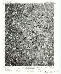
1972 Map of Stephens City
USGS Topo · Published 1977About this map
Stephens City and its surrounding agricultural landscape are captured in this 1972 orthophotograph, providing a detailed visual record of the northern Shenandoah Valley during a period of modern transit expansion. The image clearly shows the alignment of Interstate 81 and U.S. Route 11 as they pass through the town, illustrating the shift from traditional crossroads development to a modern highway-oriented corridor. To the south, the settlement of Reliance sits amidst a patchwork of cultivated fields and wooded lots, offering a clear view of land-use patterns before suburban density increased. Unlike traditional topographic maps, this aerial perspective reveals the exact footprint of farmsteads and the density of woodland cover across this Frederick County terrain.
Find a feature on this map
2 named features on this map. Tap any name to fly to it.
Don’t see what you’re looking for? This feature index may not catch every label — zoom into the map to look around manually.
Map Details
Editions of this 1972 Stephens City Map
This is the sole edition of this map. No revisions or reprints were ever made.
Other maps of this area

1893 · Luray
USGS Topo · 1:125,000

1894 · Winchester
USGS Topo · 1:125,000

1905 · Luray
USGS Topo · 1:125,000

1923 · Middletown
USGS Topo · 1:62,500

1937 · Middletown
USGS Topo · 1:48,000

1938 · Winchester
USGS Topo · 1:48,000

1939 · Front Royal
USGS Topo · 1:48,000

1942 · Winchester
USGS Topo · 1:62,500

1943 · Middletown
USGS Topo · 1:62,500

1944 · Front Royal
USGS Topo · 1:62,500