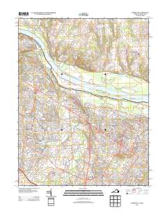
2013 Map of Sterling
USGS Topo · Published 2013About this map
Potomac River islands and suburban expansion define this Loudoun County landscape in the early 21st century. The map documents the rapid development of residential and commercial hubs including Ashburn Village, Lansdowne Town Center, and Dulles Town Center, showing how they integrated with older established areas like Broad Run Farms and Sterling Park. The transition from rural to suburban is evident in the proximity of the Doctor William B Holton Conservation Farm to modern facilities such as University Center and the Ashburn Village Sports Pavilion.
Find a feature on this map
290 named features on this map. Tap any name to fly to it.
Don’t see what you’re looking for? This feature index may not catch every label — zoom into the map to look around manually.
Map Details
Editions of this 2013 Sterling Map
This is the sole edition of this map. No revisions or reprints were ever made.
Other maps of this area

1884 · Harpers Ferry
USGS Topo · 1:125,000

1890 · Mt. Vernon
USGS Topo · 1:125,000

1891 · Harpers Ferry
USGS Topo · 1:125,000

1891 · Mt. Vernon
USGS Topo · 1:125,000

1893 · Frederick
USGS Topo · 1:125,000

1893 · Harpers Ferry
USGS Topo · 1:125,000

1894 · Warrenton
USGS Topo · 1:125,000

1894 · Frederick
USGS Topo · 1:125,000

1894 · Mt. Vernon
USGS Topo · 1:125,000

1897 · Mt. Vernon
USGS Topo · 1:125,000