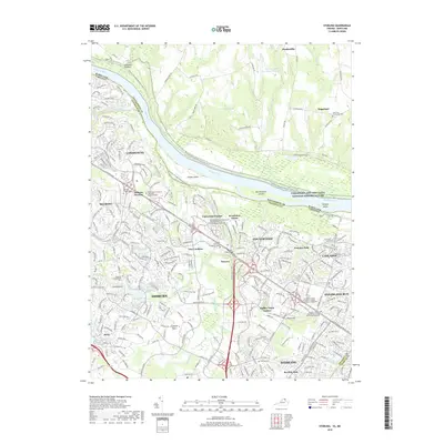
2019 Map of Sterling
USGS Topo · Published 2019About this map
Ashburn and Sterling define the landscape of this Northern Virginia corridor, where suburban development meets the historical edges of the Potomac River. The map illustrates the region's educational and commercial infrastructure, featuring campuses like the George Washington University Virginia Science and Technology Campus and the sprawling Dulles Town Center. Along the river, the Potomac Heritage National Scenic Trail winds through river islands such as Selden Island and Van Deventer Island, following the path of the Chesapeake and Ohio Canal National Historical Park.
Find a feature on this map
54 named features on this map. Tap any name to fly to it.
Don’t see what you’re looking for? This feature index may not catch every label — zoom into the map to look around manually.
Map Details
Editions of this 2019 Sterling Map
This is the sole edition of this map. No revisions or reprints were ever made.
Other maps of this area

1884 · Harpers Ferry
USGS Topo · 1:125,000

1890 · Mt. Vernon
USGS Topo · 1:125,000

1891 · Harpers Ferry
USGS Topo · 1:125,000

1891 · Mt. Vernon
USGS Topo · 1:125,000

1893 · Frederick
USGS Topo · 1:125,000

1893 · Harpers Ferry
USGS Topo · 1:125,000

1894 · Warrenton
USGS Topo · 1:125,000

1894 · Frederick
USGS Topo · 1:125,000

1894 · Mt. Vernon
USGS Topo · 1:125,000

1897 · Mt. Vernon
USGS Topo · 1:125,000