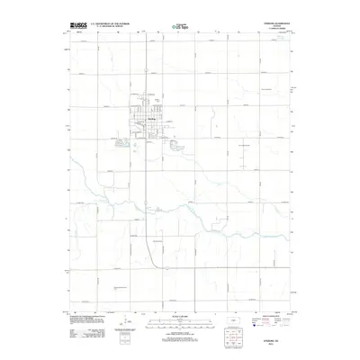
2012 Map of Sterling
USGS Topo · Published 2012About this map
The Arkansas River winds through this central Kansas landscape, shaping the southern agricultural and industrial character of the region. At the heart of the area, the town of Sterling serves as a hub of education and community life, anchored by the campus of Sterling Coll and the nearby Sterling Cem. The map reveals a grid of rural roads, including Avenue T and 14th Rd, which connect various energy production zones that define the local economy. Significant petroleum activity is evident across the quadrangle, with the Sterling Oil Field, Bull Creek Oil Field, and Dymond Oil Field situated among the fields and tributaries. Water features such as Bull Cr, Peace Cr, and the Santa Fe Slough provide drainage and landmarks for researchers studying the shifting hydrology of the river valley and its impact on settlement patterns.
Find a feature on this map
66 named features on this map. Tap any name to fly to it.
Don’t see what you’re looking for? This feature index may not catch every label — zoom into the map to look around manually.
Map Details
Editions of this 2012 Sterling Map
This is the sole edition of this map. No revisions or reprints were ever made.
Other maps of this area

1894 · Lyons
USGS Topo · 1:125,000

1955 · Great Bend
USGS Topo · 1:250,000

1957 · Great Bend
USGS Topo · 1:250,000

1958 · Great Bend
USGS Topo · 1:250,000

1960 · Yaggy
USGS Topo · 1:24,000

1966 · Sterling SW
USGS Topo · 1:24,000

1967 · Alden
USGS Topo · 1:24,000
1967 · Sterling
USGS Topo · 1:24,000

1970 · Lyons
USGS Topo · 1:24,000
1970 · Lyons SE
USGS Topo · 1:24,000