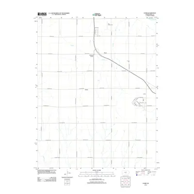
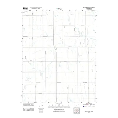
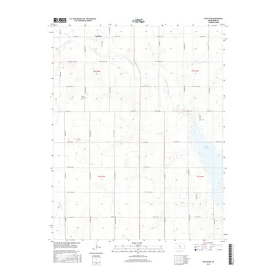
1966 Map of Sterling SW
USGS Topo · Published 1968About this map
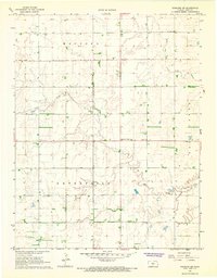
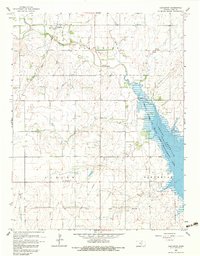
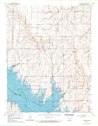
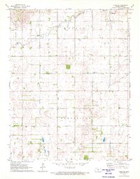
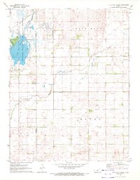
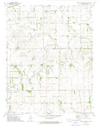
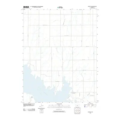
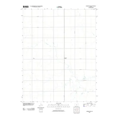
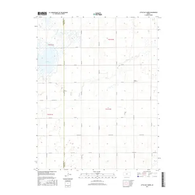
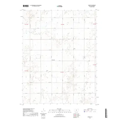
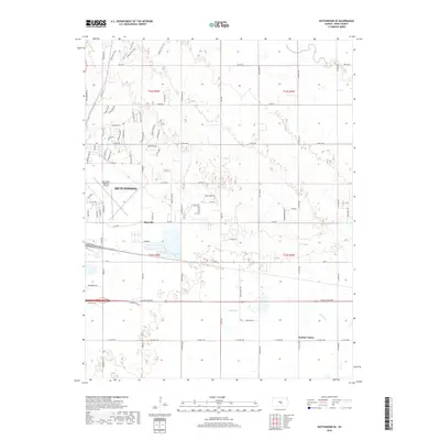
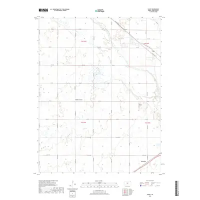
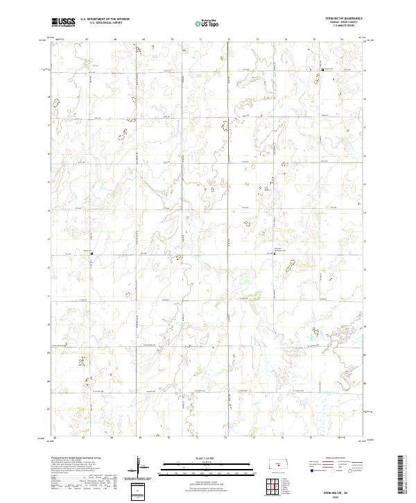
Salt Creek meanders across the central landscape of this Reno County township, defining the drainage patterns for a region organized into the districts of Medford, Salt Creek, and Enterprise. In the mid-1960s, the area remained a predominantly agricultural expanse marked by a grid of rural roads and scattered cultural landmarks. The small crossroads at Charters Corner serves as a primary local waypoint, while the presence of the Radio Tower in the northwest suggests the early modern technological infrastructure of the era. The mapping of the Salem Ch, Peace Cem, and the combined Fairview Ch Cem provides essential locations for those researching family history and early community centers in this section of the Kansas plains. Further north, the passage of Dry Creek cuts through the surveyed sections, illustrating the natural watercourses that shaped local land use and farm placement.
Find a feature on this map
12 named features on this map. Tap any name to fly to it.
Don’t see what you’re looking for? This feature index may not catch every label — zoom into the map to look around manually.
Map Details
Editions of this 1966 Sterling SW Map
This is the sole edition of this map. No revisions or reprints were ever made.
Historical Maps of Charters Corner Through Time
54 maps found
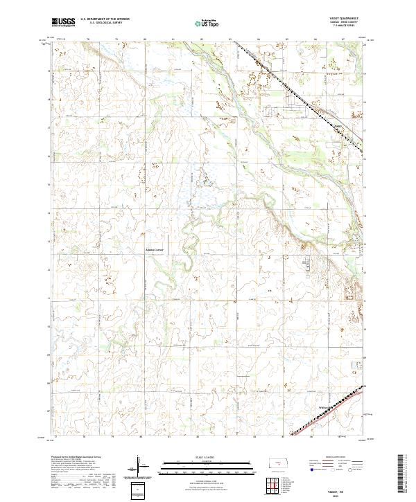
1960 Yaggy
Reno County, KS
1961 Elmer
Reno County, KS
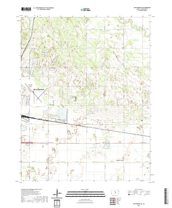
1961 Hutchinson SE
Reno County, KS
1965 Castleton
Reno County, KS
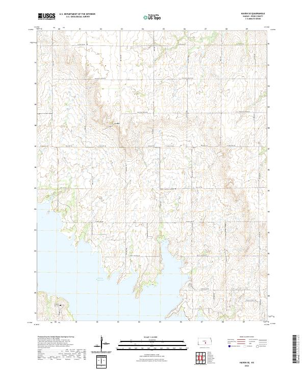
1965 Haven SE
Reno County, KS
1966 Sterling SW
Reno County, KS
1971 Alden SE
Reno County, KS
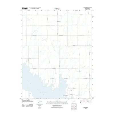
1971 Little Salt Marsh
Reno County, KS
1971 Pretty Prairie SW
Reno County, KS
2009 Alden SE
Reno County, KS
2009 Castleton
Reno County, KS
2009 Elmer
Reno County, KS
2009 Haven SE
Reno County, KS
2009 Hutchinson SE
Reno County, KS
2009 Little Salt Marsh
Reno County, KS
2009 Pretty Prairie SW
Reno County, KS
2009 Sterling SW
Reno County, KS
2009 Yaggy
Reno County, KS
2012 Alden SE
Reno County, KS
2012 Castleton
Reno County, KS
2012 Elmer
Reno County, KS
2012 Haven SE
Reno County, KS
2012 Hutchinson SE
Reno County, KS
2012 Little Salt Marsh
Reno County, KS
2012 Pretty Prairie SW
Reno County, KS
2012 Sterling SW
Reno County, KS
2012 Yaggy
Reno County, KS
2015 Alden SE
Reno County, KS
2015 Castleton
Reno County, KS
2015 Elmer
Reno County, KS
2015 Haven SE
Reno County, KS
2015 Hutchinson SE
Reno County, KS
2015 Little Salt Marsh
Reno County, KS
2015 Pretty Prairie SW
Reno County, KS
2015 Sterling SW
Reno County, KS
2015 Yaggy
Reno County, KS
2018 Alden SE
Reno County, KS
2018 Castleton
Reno County, KS
2018 Elmer
Reno County, KS
2018 Haven SE
Reno County, KS
2018 Hutchinson SE
Reno County, KS
2018 Little Salt Marsh
Reno County, KS
2018 Pretty Prairie SW
Reno County, KS
2018 Sterling SW
Reno County, KS
2018 Yaggy
Reno County, KS
2022 Alden SE
Reno County, KS
2022 Castleton
Reno County, KS
2022 Elmer
Reno County, KS
2022 Haven SE
Reno County, KS
2022 Hutchinson SE
Reno County, KS

2022 Little Salt Marsh
Reno County, KS

2022 Pretty Prairie SW
Reno County, KS
2022 Sterling SW
Reno County, KS
2022 Yaggy
Reno County, KS