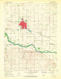
1967 Map of Sterling
USGS Topo · Published 1968About this map
Sterling serves as a significant institutional hub in central Kansas, anchored by the campus of Sterling College and several local schools like High Sch and Union Sch. The town is situated at a strategic intersection of transportation and industry, where the Missouri Pacific railroad crosses paths with the Atchison Topeka and Santa Fe line. Just south of the municipal center, the landscape transitions from the residential grid to the hydraulic and extraction features of the Arkansas River valley, including numerous Sandpits and the petroleum-rich Sterling Southwest Field. Geographers will note the intricate drainage patterns of Bull Creek and Dry Creek as they approach the river. Local landmarks such as the Sterling Cemetery, Sterling Airport, and City Hall provide essential points of reference for genealogists and researchers studying the mid-century development of Rice and Reno counties.
Find a feature on this map
26 named features on this map. Tap any name to fly to it.
Don’t see what you’re looking for? This feature index may not catch every label — zoom into the map to look around manually.
Map Details
Editions of this 1967 Sterling Map
This is the sole edition of this map. No revisions or reprints were ever made.
Other maps of this area

1894 · Lyons
USGS Topo · 1:125,000

1955 · Great Bend
USGS Topo · 1:250,000

1957 · Great Bend
USGS Topo · 1:250,000

1958 · Great Bend
USGS Topo · 1:250,000

1960 · Yaggy
USGS Topo · 1:24,000

1966 · Sterling SW
USGS Topo · 1:24,000

1967 · Alden
USGS Topo · 1:24,000

1970 · Lyons
USGS Topo · 1:24,000
1970 · Lyons SE
USGS Topo · 1:24,000
1970 · Nickerson
USGS Topo · 1:24,000