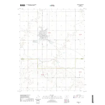
2018 Map of Sterling
USGS Topo · Published 2018About this map
The town of Sterling serves as the focal point of this Central Kansas landscape, where the grid of a settled community meets the meandering path of the Arkansas River. The street network is well-defined by central arteries like N Broadway Ave and W Main St, reflecting a well-established agricultural and residential hub. North of the town center, the Sterling Cem provides a point of genealogical interest for those tracing family roots in Rice County.
Find a feature on this map
70 named features on this map. Tap any name to fly to it.
Don’t see what you’re looking for? This feature index may not catch every label — zoom into the map to look around manually.
Map Details
Editions of this 2018 Sterling Map
This is the sole edition of this map. No revisions or reprints were ever made.
Other maps of this area

1894 · Lyons
USGS Topo · 1:125,000

1955 · Great Bend
USGS Topo · 1:250,000

1957 · Great Bend
USGS Topo · 1:250,000

1958 · Great Bend
USGS Topo · 1:250,000

1960 · Yaggy
USGS Topo · 1:24,000

1966 · Sterling SW
USGS Topo · 1:24,000

1967 · Alden
USGS Topo · 1:24,000
1967 · Sterling
USGS Topo · 1:24,000

1970 · Lyons
USGS Topo · 1:24,000
1970 · Lyons SE
USGS Topo · 1:24,000