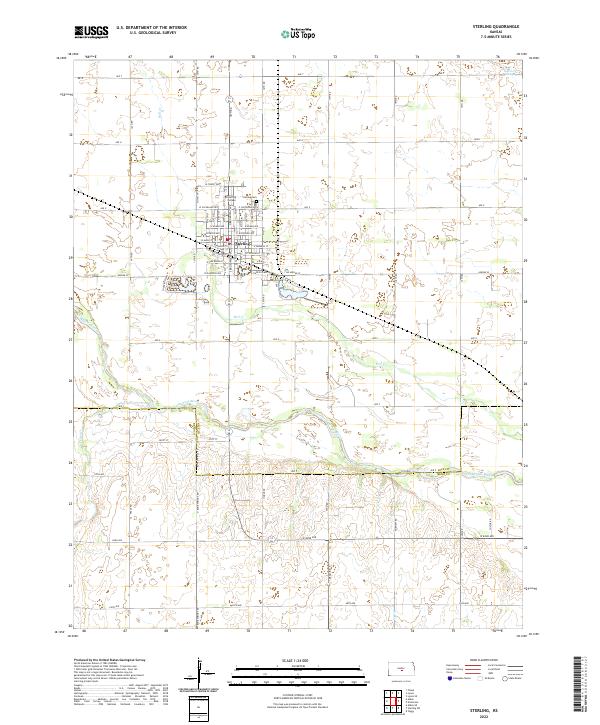
2022 Map of Sterling
USGS Topo · Published 2022About this map
The town of Sterling anchors this Central Kansas landscape, defined by the organized grid of the settlement and the meandering path of the Arkansas River to the south. Historically significant landmarks are clustered within the town, including the campus of Sterling College and the Sterling Cem at its northern edge. The area reflects a classic rural layout where numbered avenues like Ave T and Ave U intersect with rural roads such as Bone Springs Rd, facilitating the agricultural movement across the plains.
Find a feature on this map
55 named features on this map. Tap any name to fly to it.
Don’t see what you’re looking for? This feature index may not catch every label — zoom into the map to look around manually.
Map Details
Editions of this 2022 Sterling Map
This is the sole edition of this map. No revisions or reprints were ever made.
Other maps of this area

1894 · Lyons
USGS Topo · 1:125,000

1955 · Great Bend
USGS Topo · 1:250,000

1957 · Great Bend
USGS Topo · 1:250,000

1958 · Great Bend
USGS Topo · 1:250,000

1960 · Yaggy
USGS Topo · 1:24,000

1966 · Sterling SW
USGS Topo · 1:24,000

1967 · Alden
USGS Topo · 1:24,000
1967 · Sterling
USGS Topo · 1:24,000

1970 · Lyons
USGS Topo · 1:24,000
1970 · Lyons SE
USGS Topo · 1:24,000