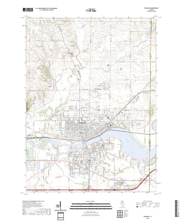
2024 Map of Sterling
USGS Topo · Published 2024About this map
The Rock River serves as the central anchor for the twin cities of Sterling and Rock Falls in this modern topographic study of Whiteside County. The urban landscape is defined by its industrial corridors and residential expansion, including the Yeoward Addition and the nearby village of Galt. A significant density of religious and commemorative sites reflects the area's deep community roots, from the Grace Episcopal Church Columbarium in the city center to the Science Ridge Mennonite Cem on the northern outskirts.
Find a feature on this map
189 named features on this map. Tap any name to fly to it.
Don’t see what you’re looking for? This feature index may not catch every label — zoom into the map to look around manually.
Map Details
Editions of this 2024 Sterling Map
This is the sole edition of this map. No revisions or reprints were ever made.
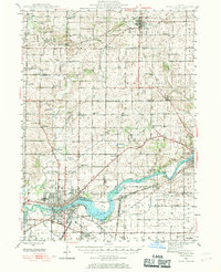
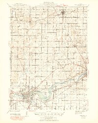
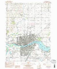
Historical Maps of Nelson Township Through Time
4 maps found