
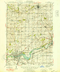
1948 Map of Sterling
USGS Topo · Published 1948About this map
Sterling and Rock Falls anchor this mid-century survey as they straddle the Rock River, showcasing a period of industrial and residential stability along the waterway. The Chicago and Northwestern and Chicago Burlington and Quincy railroads weave through the landscape, connecting these urban centers to outlying hamlets like Polo and Prairieville. The rural townships are meticulously documented, revealing a dense network of one-room schoolhouses such as Buffalo Grove Sch, Donaldson Sch, and East Science Ridge Sch that served the farming communities before mid-century consolidation. Local history is preserved through numerous family-named cemeteries and landmarks, including the Plum Hollow Golf Course and small rural intersections like Hazelhurst and Penrose. The map illustrates the transition from the concentrated riverfront industry of the Yeoward Addition to the wide agricultural expanses of Eagle and Buffalo townships.
Find a feature on this map
88 named features on this map. Tap any name to fly to it.
Don’t see what you’re looking for? This feature index may not catch every label — zoom into the map to look around manually.
Map Details
Editions of this 1948 Sterling Map
2 editions found
Other maps of this area

1918 · Dixon
USGS Topo · 1:62,500

1922 · Oregon
USGS Topo · 1:62,500

1924 · Oregon
USGS Topo · 1:62,500

1930 · Woodsung
USGS Topo · 1:48,000

1932 · Prophetstown
USGS Topo · 1:48,000

1934 · Morrison
USGS Topo · 1:48,000

1936 · Prophetstown
USGS Topo · 1:62,500

1940 · Morrison
USGS Topo · 1:62,500

1942 · Mt Carroll
USGS Topo · 1:62,500

1942 · Forreston
USGS Topo · 1:62,500