
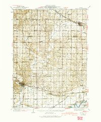
1934 Map of Morrison
USGS Topo · Published 1934About this map
The county seat of Morrison serves as a major hub for this portion of Whiteside County, where the Chicago and Northwestern railroad dictates the local geography of commerce and transit. Agriculture is the primary driver of the region, evidenced by a dense grid of rural schools like Washington School and Lafayette School that served the farm families of Genesee and Mt Pleasant townships. In the southern reach of the map, the Rock River flows near the village of Como, while to the north, the terrain becomes more dissected by Rock Creek and Otter Creek. This survey captures the transition from a nineteenth-century landscape of small villages like Malvern and Coleta to the more consolidated rail-based economy of the 1930s. Notable community landmarks include Grove Hill Cemetery and the Brick Church, providing essential points of reference for genealogical research in this Illinois prairie landscape.
Find a feature on this map
95 named features on this map. Tap any name to fly to it.
Don’t see what you’re looking for? This feature index may not catch every label — zoom into the map to look around manually.
Map Details
Editions of this 1934 Morrison Map
2 editions found
Other maps of this area

1891 · Clinton
USGS Topo · 1:62,500

1892 · Savanna
USGS Topo · 1:62,500

1894 · Clinton
USGS Topo · 1:62,500

1899 · Clinton
USGS Topo · 1:125,000

1930 · Woodsung
USGS Topo · 1:48,000

1932 · Prophetstown
USGS Topo · 1:48,000

1936 · Prophetstown
USGS Topo · 1:62,500

1940 · Morrison
USGS Topo · 1:62,500

1942 · Mt Carroll
USGS Topo · 1:62,500

1942 · Forreston
USGS Topo · 1:62,500