
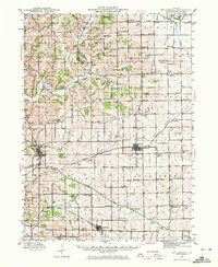
1942 Map of Mt Carroll
USGS Topo · Published 1959About this map
Mt Carroll serves as the focal point of this Northwest Illinois landscape, where a dense network of country roads connects a high concentration of rural schoolhouses and churches during the early 1940s. The landscape is defined by the intersections of three major railroads: the Chicago Milwaukee St Paul and Pacific, the Chicago Great Western, and the Chicago Burlington and Quincy, which facilitate movement between regional hubs like Lanark and Chadwick. The map reveals a highly structured agricultural society, evidenced by the proliferation of neighborhood institutions such as Mission Ridge Sch, Sabin Ch, and the Spring Valley Cem. Along the winding path of the Plum River and Carroll Creek, the terrain transitions from steady farm plots to the prominent Mission Ridge, illustrating the relationship between the area's limestone geology—noted at the Quarry—and its settlement patterns.
Find a feature on this map
89 named features on this map. Tap any name to fly to it.
Don’t see what you’re looking for? This feature index may not catch every label — zoom into the map to look around manually.
Map Details
Editions of this 1942 Mt Carroll Map
2 editions found
Other maps of this area

1891 · Clinton
USGS Topo · 1:62,500

1892 · Savanna
USGS Topo · 1:62,500

1894 · Clinton
USGS Topo · 1:62,500

1899 · Clinton
USGS Topo · 1:125,000

1911 · Elizabeth
USGS Topo · 1:62,500

1930 · Woodsung
USGS Topo · 1:48,000

1934 · Morrison
USGS Topo · 1:48,000

1936 · Elizabeth
USGS Topo · 1:62,500

1937 · Lena
USGS Topo · 1:48,000

1939 · Freeport
USGS Topo · 1:48,000