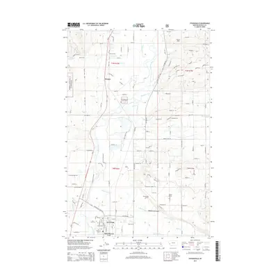
2014 Map of Stevensville
USGS Topo · Published 2014About this map
The Bitterroot River valley anchors this 21st-century view of Stevensville, showing the residential expansion and agricultural patterns of the Bitterroot Valley. This area represents a blend of established history and modern development, evidenced by the proximity of the Saint Marys Cem and Maplewood Cem to newer residential clusters like Bitterroot Court and Apple Blossom Court. To the north, the small settlement of Kenspur sits near the base of the foothills where the Bitterroot National Forest begins its ascent into the mountains. The landscape is deeply defined by water management and drainage, with features such as Threemile Creek, N Burnt Fork Cr, and the Stevensville Reservoir sustaining the surrounding lands. The Stevensville Airport and North Bench highlight the infrastructure supporting this Montana community during a period of steady growth.
Find a feature on this map
122 named features on this map. Tap any name to fly to it.
Don’t see what you’re looking for? This feature index may not catch every label — zoom into the map to look around manually.
Map Details
Editions of this 2014 Stevensville Map
This is the sole edition of this map. No revisions or reprints were ever made.
Other maps of this area

1901 · Hamilton
USGS Topo · 1:125,000

1903 · Bonner
USGS Topo · 1:125,000

1909 · Sapphire
USGS Topo · 1:125,000

1912 · Missoula
USGS Topo · 1:125,000

1947 · Butte
USGS Topo · 1:250,000

1956 · Hamilton
USGS Topo · 1:250,000

1958 · Butte
USGS Topo · 1:250,000

1959 · Hamilton
USGS Topo · 1:250,000

1959 · Cleveland Mountain
USGS Topo · 1:62,500

1960 · Butte
USGS Topo · 1:250,000