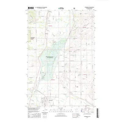
2017 Map of Stevensville
USGS Topo · Published 2017About this map
Stevensville serves as the hub of this Bitterroot Valley corridor, where the town grid is defined by historical sites such as Saint Marys Cem and Maplewood Cem. The riverine landscape is dominated by the Bitterroot River, which feeds a complex system of waterways including Mill Cr and N Burnt Fork Cr. Significant conservation areas flank the valley, with the Lee Metcalf National Wildlife Refuge protecting the wetlands and the Bitterroot National Forest rising to the west. Small settlements like Florence and Kenspur align with the primary north-south transit routes, reflecting the region's agricultural and aviation history, the latter represented by the Stevensville Airport. The map documents a blend of residential growth and preserved wildlands, evidenced by the numerous named roads like Old Eastside Hwy and Saint Joseph Ln that wind toward the foothills of Antrim Point.
Find a feature on this map
136 named features on this map. Tap any name to fly to it.
Don’t see what you’re looking for? This feature index may not catch every label — zoom into the map to look around manually.
Map Details
Editions of this 2017 Stevensville Map
This is the sole edition of this map. No revisions or reprints were ever made.
Other maps of this area

1901 · Hamilton
USGS Topo · 1:125,000

1903 · Bonner
USGS Topo · 1:125,000

1909 · Sapphire
USGS Topo · 1:125,000

1912 · Missoula
USGS Topo · 1:125,000

1947 · Butte
USGS Topo · 1:250,000

1956 · Hamilton
USGS Topo · 1:250,000

1958 · Butte
USGS Topo · 1:250,000

1959 · Hamilton
USGS Topo · 1:250,000

1959 · Cleveland Mountain
USGS Topo · 1:62,500

1960 · Butte
USGS Topo · 1:250,000