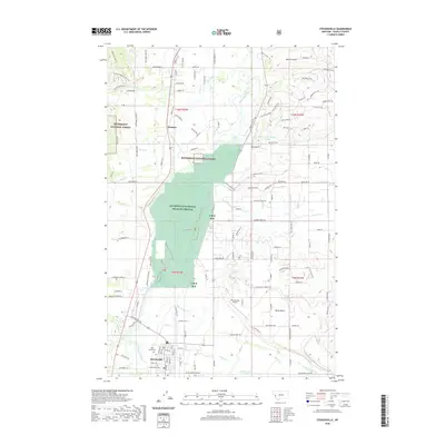
2020 Map of Stevensville
USGS Topo · Published 2020About this map
Stevensville serves as the focal point of this Ravalli County landscape, where the valley floor transitions into the protected environments of the Lee Metcalf National Wildlife Refuge. The settlement pattern reflects the area's spiritual and civic history, with both Saint Marys Cem and Maplewood Cem situated near the town center. To the north, the small community of Kenspur sits along the primary highway corridor, while the Bitterroot National Forest borders the western valley walls.
Find a feature on this map
152 named features on this map. Tap any name to fly to it.
Don’t see what you’re looking for? This feature index may not catch every label — zoom into the map to look around manually.
Map Details
Editions of this 2020 Stevensville Map
This is the sole edition of this map. No revisions or reprints were ever made.
Other maps of this area

1901 · Hamilton
USGS Topo · 1:125,000

1903 · Bonner
USGS Topo · 1:125,000

1909 · Sapphire
USGS Topo · 1:125,000

1912 · Missoula
USGS Topo · 1:125,000

1947 · Butte
USGS Topo · 1:250,000

1956 · Hamilton
USGS Topo · 1:250,000

1958 · Butte
USGS Topo · 1:250,000

1959 · Hamilton
USGS Topo · 1:250,000

1959 · Cleveland Mountain
USGS Topo · 1:62,500

1960 · Butte
USGS Topo · 1:250,000