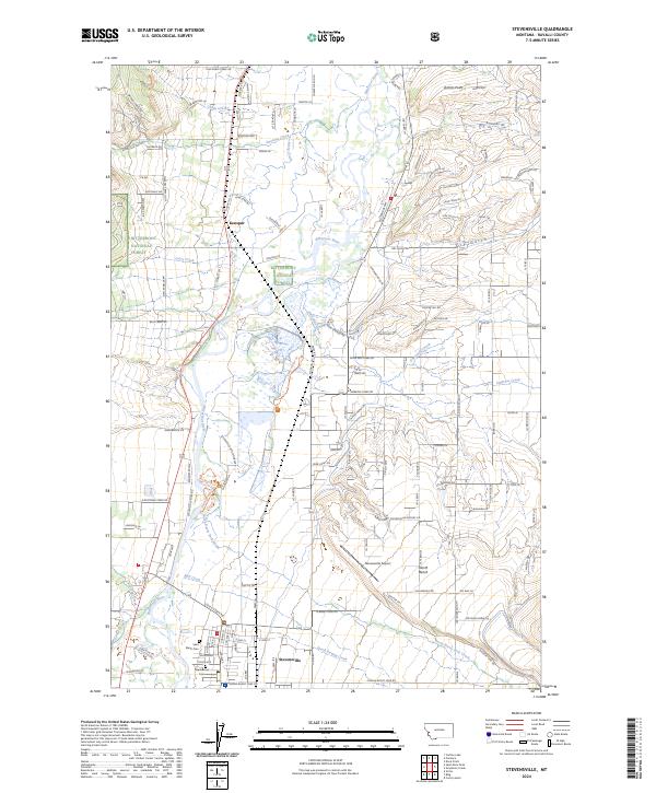
2024 Map of Stevensville
USGS Topo · Published 2024About this map
Stevensville serves as the focal point of this Ravalli County survey, situated just east of the Bitterroot River. The town's historical roots are anchored by Saint Marys Cem and Maplewood Cem, while its modern infrastructure includes the Stevensville Airport. To the north, the small settlement of Kenspur lies near the intricate wetlands of the Lee Metcalf National Wildlife Refuge, which spans a significant portion of the river bottom. The landscape transitions from the riparian corridors of North Swamp Creek and Mill Creek to the elevated terrain of North Bench. The western edge of the quadrangle rises into the Bitterroot National Forest, where steep drainages like Sweeney Creek and Larry Creek feed into the valley, illustrating the classic Montana interface between protected wilderness and fertile valley floor.
Find a feature on this map
139 named features on this map. Tap any name to fly to it.
Don’t see what you’re looking for? This feature index may not catch every label — zoom into the map to look around manually.
Map Details
Editions of this 2024 Stevensville Map
This is the sole edition of this map. No revisions or reprints were ever made.
Other maps of this area

1901 · Hamilton
USGS Topo · 1:125,000

1903 · Bonner
USGS Topo · 1:125,000

1909 · Sapphire
USGS Topo · 1:125,000

1912 · Missoula
USGS Topo · 1:125,000

1947 · Butte
USGS Topo · 1:250,000

1956 · Hamilton
USGS Topo · 1:250,000

1958 · Butte
USGS Topo · 1:250,000

1959 · Hamilton
USGS Topo · 1:250,000

1959 · Cleveland Mountain
USGS Topo · 1:62,500

1960 · Butte
USGS Topo · 1:250,000