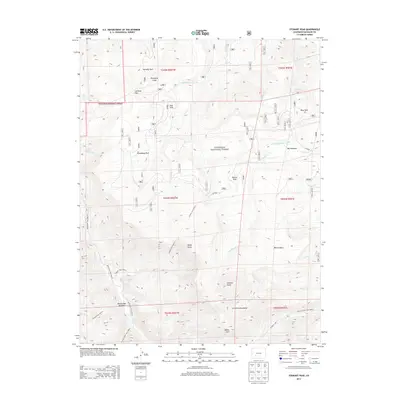
2013 Map of Stewart Peak
USGS Topo · Published 2013About this map
Stewart Peak and the high alpine ridges of the La Garita Mountains dominate this high-altitude section of the Gunnison National Forest. The landscape is defined by its drainages and mountain passes, where several headwater streams like Los Pinos Cr and Stewart Cr begin their descent from the peaks. The infrastructure of the area is primarily composed of backcountry trails and forest roads, including the Cebolla Trail 9459.0 and Bondholder Trail 9467.0, which connect high-country meadows like Horsefly Park, Groundhog Park, and Bondholder Meadows. This 2013 survey illustrates the complex geography of the continental divide's western slopes, showing the relationship between prominent summits like Baldy Chato and Baldy Alto and the critical water management features like the Cochetopa Meadows Ditch found at lower elevations.
Find a feature on this map
39 named features on this map. Tap any name to fly to it.
Don’t see what you’re looking for? This feature index may not catch every label — zoom into the map to look around manually.
Map Details
Editions of this 2013 Stewart Peak Map
This is the sole edition of this map. No revisions or reprints were ever made.
Other maps of this area

1905 · San Cristobal
USGS Topo · 1:125,000

1907 · San Cristobal
USGS Topo · 1:125,000

1908 · Uncompahgre
USGS Topo · 1:125,000

1911 · Uncompahgre
USGS Topo · 1:125,000

1914 · Creede
USGS Topo · 1:125,000

1916 · Creede
USGS Topo · 1:125,000

1945 · Durango
USGS Topo · 1:250,000

1953 · Durango
USGS Topo · 1:250,000

1954 · Durango
USGS Topo · 1:250,000

1956 · Montrose
USGS Topo · 1:250,000