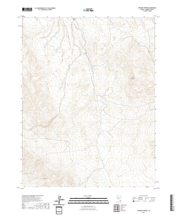
2021 Map of Stewart Spring
USGS Topo · Published 2021About this map
Stewart Valley and the Cedar Mountains define this high-desert landscape in Mineral County, where water is the primary architect of both the terrain and its history. The map shows a classic Great Basin drainage pattern, dominated by the long southward reach of Finger Rock Wash and Omco Wash. These ephemeral watercourses are punctuated by essential life-sustaining points like Stewart Spring and Wildrose Spring, which have historically served as critical nodes for travel and livestock in an arid environment.
Find a feature on this map
14 named features on this map. Tap any name to fly to it.
Don’t see what you’re looking for? This feature index may not catch every label — zoom into the map to look around manually.
Map Details
Editions of this 2021 Stewart Spring Map
This is the sole edition of this map. No revisions or reprints were ever made.
Other maps of this area

1907 · Tonopah
USGS Topo · 1:250,000

1908 · Tonopah
USGS Topo · 1:250,000

1909 · Hawthorne
USGS Topo · 1:250,000

1911 · Hawthorne
USGS Topo · 1:250,000

1915 · Hawthorne
USGS Topo · 1:250,000

1948 · Walker Lake
USGS Topo · 1:250,000

1956 · Tonopah
USGS Topo · 1:250,000

1957 · Walker Lake
USGS Topo · 1:250,000

1959 · Tonopah
USGS Topo · 1:250,000

1962 · Walker Lake
USGS Topo · 1:250,000