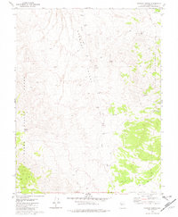
1979 Map of Stewart Spring
USGS Topo · Published 1980About this map
Stewart Valley and the surrounding high desert basins are defined by a sparse but vital network of water sources and mining activity. In this arid corner of Nevada, life centered on isolated points like Simon Well, Stewart Spring, and Black Cabin Well. These wells and springs provided the necessary hydration for prospectors and livestock navigating the desert between the Gabbs Valley Range and the Cedar Mountains. The landscape's industrial character is marked by the OMCO Mine and its associated tailings, alongside various borrow pits and a scattered prospect in the southwest. Transport through this basin-and-range terrain relied heavily on a network of jeep trails and older trails that follow the natural contours of Finger Rock Wash, illustrating the rugged logistics of Mineral County in the late 1970s.
Find a feature on this map
18 named features on this map. Tap any name to fly to it.
Don’t see what you’re looking for? This feature index may not catch every label — zoom into the map to look around manually.
Map Details
Editions of this 1979 Stewart Spring Map
This is the sole edition of this map. No revisions or reprints were ever made.
Other maps of this area

1907 · Tonopah
USGS Topo · 1:250,000

1908 · Tonopah
USGS Topo · 1:250,000

1909 · Hawthorne
USGS Topo · 1:250,000

1911 · Hawthorne
USGS Topo · 1:250,000

1915 · Hawthorne
USGS Topo · 1:250,000

1948 · Walker Lake
USGS Topo · 1:250,000

1956 · Tonopah
USGS Topo · 1:250,000

1957 · Walker Lake
USGS Topo · 1:250,000

1959 · Tonopah
USGS Topo · 1:250,000

1962 · Walker Lake
USGS Topo · 1:250,000